From coral-ringed islands to pine-cloaked peaks, Honduras unfolds like a living atlas. A map of honduras is more than lines and labels; it is your compass to beaches, ruins, rainforests, and vibrant cities. Use it to trace coast-to-coast journeys, connect cultural routes, and plan detours to waterfalls and wildlife-rich trails. This guide blends cartography with on-the-ground insight so you can navigate confidently and discover the country’s character along the way.
💡 Key Takeaways
- Honduras spans approximately 112,492 km² and is home to diverse ecosystems.
- The capital city is Tegucigalpa, known for its vibrant culture and history.
- Top tourist destinations include the Bay Islands, Copán Ruinas, and La Mosquitia.
Overview of Honduras
Honduras is Central America’s second-largest nation, covering 112,492 km² of Caribbean coast, Pacific bay, high mountain ridges, cloud forests, and fertile valleys. Its capital, Tegucigalpa, sits amid rolling hills in the south-central highlands, balancing colonial legacies with modern business districts. Spanish is the official language, yet regional cultures and languages enrich everyday life in markets, fishing towns, and mountain villages.
On any map of honduras you will see two distinct coasts: a long Caribbean frontage dotted with islands and lagoons, and a short Pacific shoreline on the Gulf of Fonseca. Between them rise rugged sierras and green basins crisscrossed by rivers that carve routes to cities, national parks, and archaeological sites. This varied terrain creates microclimates, road challenges, and rewarding detours that shape every itinerary.
Major Cities and Regions
Tegucigalpa and its twin city Comayagüela form the political heart of the country, their hills threaded by narrow streets, museums, and hillside viewpoints. San Pedro Sula anchors the industrial north and serves as a gateway to the Sula Valley, Caribbean beaches, and the western highlands. La Ceiba, nicknamed the ecotourism capital, sits at the foot of Pico Bonito and hosts a legendary May carnival that spills into the streets.
To the north, the Bay Islands entice divers with reef walls, whale shark encounters, and laid-back towns; Roatán’s West Bay is famous for clear shallows, while Utila’s rustic vibe attracts budget travelers and dive trainees. Westward, the Copán region is a cradle of Maya heritage, its cobbled town leading to ancient plazas and sculpture-filled temples. South of the mountains, Choluteca and the Pacific lowlands feel sunbaked and maritime, offering seafood and access to the Gulf of Fonseca’s volcanic silhouettes.
Central Honduras holds Comayagua with a grand cathedral and colonial avenues, and Lake Yojoa where coffee farms and birdlife flank the water’s edge. In the northeast, La Mosquitia stretches into wetlands, forests, and indigenous territories hardly touched by roads. Each region reads differently on a map: tight switchbacks in the west, straight coastal arteries in the north, and broad valleys where highways rush beside meandering rivers.
Geographical Features
Honduras is a tapestry of mountain ranges, river systems, and coastal plains, framed by the Caribbean Sea to the north and the Gulf of Fonseca to the south. Elevation shapes climate: cool pine forests blanket high ridges while warm, humid air fuels mangroves and reefs along the Caribbean. When you overlay climate and elevation on a map of honduras, road gradients, cloud-forest trailheads, and snorkeling sites begin to align logically.
Two dominant highlands stand out. The western ranges culminate in Cerro Las Minas in Celaque National Park, reaching Cerro Las Minas (2,870 m), while the Nombre de Dios and Cordillera de Agalta systems run east, guarding rivers like the Aguán and Patuca. Valley floors such as the Sula and Comayagua basins host agriculture, highways, and cities, making them practical corridors for road trips and bus routes.
Topographical Map of Honduras
A topographical map of honduras paints the country in contours and color bands: greens for lowlands, yellows for mid-elevations, and browns for high peaks. In the west, tight contour lines cluster around the Celaque massif and the Sierra de Omoa, signaling steep climbs that slow travel but reward hikers with cloud-forest vistas. Eastward, broad contour spacing in La Mosquitia reveals low, swampy landscapes that favor river and lagoon travel over roads.
Trace the Ulúa and Chamelecón rivers as they carve the Sula Valley; these waterways explain the valley’s fertile soils and why the San Pedro Sula corridor is dotted with farms and towns. On the north coast, the Nombre de Dios mountains rise sharply behind La Ceiba, which is why short drives turn into dramatic altitude gains toward Pico Bonito trailheads. Offshore, the Bay Islands sit atop the Mesoamerican Barrier Reef; nautical charts complement your land map to locate moorings and walls within a few fin kicks of the beach.
Practical reading tips make a difference. If you plan to drive from Tegucigalpa to Copán Ruinas, contours and passes show why routes via La Esperanza or Santa Rosa de Copán differ in time and scenery. When crossing from La Ceiba to Trujillo, note the narrow coastal plain pinched between sea and mountains, where any landslide can reroute traffic inland. For trekkers, elevation profiles help judge a two-day ascent in Cusuco or a cooler morning start through La Tigra’s oak and pine.
Key Attractions
Plotting must-see spots on a map of honduras reveals a classic loop: cities and lakes in the central highlands, Maya sites in the west, reefs and beaches in the north, and untouched wilderness in the east. Clustering experiences reduces backtracking: combine Copán’s archaeology with coffee fincas, pair La Ceiba’s carnival with whitewater in the Cangrejal River, and cap it with reef days on Roatán or Utila.
Travelers often build their plans around three magnets: the Bay Islands, the ruins of Copán Ruinas, and the wild wetlands of La Mosquitia. Each demands a different pace. Diving and beach time benefit from unhurried days, archaeology opens doors to guided interpretation, and rainforest expeditions require permits, reliable boats, and experienced local guides.
Natural Parks and Reserves
Near Tegucigalpa, La Tigra National Park protects the country’s oldest national park trails through cloud forest, alive with quetzals and orchids after misty mornings. Around Lake Yojoa, PANACAM (Parque Nacional Montaña de Azul Meambar) offers birding lodges, waterfall hikes, and panoramic ridgelines; the nearby Los Naranjos Eco-archaeological Park mixes boardwalks with pre-Hispanic mounds in a single outing.
North of San Pedro Sula, Cusuco National Park shelters dwarf forests and endemic amphibians in high-altitude pockets, a dream for naturalists willing to tackle steep tracks. East of La Ceiba, Pico Bonito National Park rises almost from sea level to the clouds, feeding the Cangrejal River’s boulder gardens and Class III–IV rapids that are easily scouted from bridges and access points marked on maps.
On the Caribbean, Jeanette Kawas National Park stretches from beaches to lagoons near Tela, where mangrove channels open into bird-filled mirror waters. Offshore, the Cayos Cochinos archipelago is a tiny, protected cluster of cays with strict visitation rules that safeguard coral and traditional fishing. In the far northeast, the UNESCO-listed Río Plátano Biosphere Reserve anchors La Mosquitia’s wilderness, where dugout canoes, community lodges, and wildlife tracking replace paved roads and hotel blocks.
Historical Sites
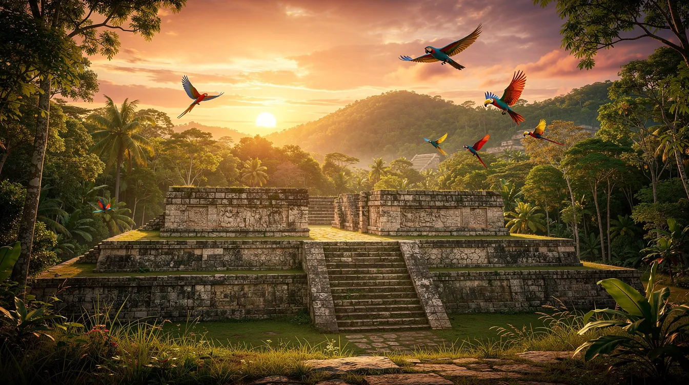
At the western frontier, Copán Ruinas ranks among the finest Maya city-states for its artistic stonework. The Hieroglyphic Stairway and sculpted stelae turn a stroll into a reading of history. Nearby, the Copán Sculpture Museum preserves originals while the acropolis unveils tunnels that reveal construction phases layer by layer. The smaller El Puente site, on the way toward La Entrada, offers a quieter complement with explanatory signage and forest shade.
In the heartland, Comayagua’s cathedral houses a storied clock and baroque altarpieces, while its plazas frame Holy Week sawdust carpets that create temporary masterpieces. Along the Caribbean, the San Fernando Fortress in Omoa and the Santa Bárbara Fortress in Trujillo recall colonial struggles for coastal control, their ramparts mapping the arc of Spanish trade and defense. At Lake Yojoa, the Los Naranjos site blends natural and human history, where raised walkways pass ceiba trees and ancient earthworks in the same green embrace.
Cultural Insights

Honduras thrives on cultural diversity expressed in food, music, crafts, and everyday rhythms. On the north coast, the Garifuna community sustains drumming, dance, and coastal cuisine; in the western highlands, Lenca towns like La Campa and Gracias host pottery traditions and markets. Overlay these communities on a map of honduras and you can follow living traditions along scenic byways such as the Ruta Lenca between La Esperanza, Gracias, and Santa Rosa de Copán.
Mestizo culture shapes much of urban Honduras, yet the country’s identity is also carried by Miskito, Pech, Tawahka, and Tolupan peoples whose territories lie in forests and along rivers. Festivals and foodways act as navigational beacons, guiding itineraries as surely as road signs. Plan city visits to coincide with La Ceiba’s carnival in May, or schedule quiet, cool mornings for market walks in mountain towns where coffee aromas and loom-woven textiles color the day.
Local Cuisine and Traditions
Start with baleadas, the beloved flour tortilla folded over refried beans, crema, and cheese, often ordered “sencilla” or loaded with eggs and avocado. On the coast, sopa de caracol and machuca pair rich coconut broths with fresh seafood and mashed plantains, recipes nurtured in Garifuna kitchens. Inland, plato típico plates up grilled meat, beans, tajadas, and chimol, while tamales and pastelitos fill bakery windows in the afternoon rush.
Honduran coffee shines in cafés from Marcala to Copán, where tastings highlight altitude, roast, and varietal; cacao experiences near La Ceiba and in western valleys reveal how beans transform into spiced drinking chocolate. Music and dance move to punta rhythms in coastal towns, marimba and guitar in plazas, and marching bands during civic holidays. In Comayagua, Holy Week carpets turn streets into color-saturated pathways, a temporary art map that pilgrims and photographers follow all day.
Etiquette is simple: greet with a friendly “buenos días,” ask before photographing people or ceremonies, and buy from artisans directly when possible. Community-run tours in Garifuna and Lenca towns channel your spending into local livelihoods and often include cooking classes, drumming lessons, or pottery workshops that deepen your understanding beyond typical sightseeing.
Travel Tips
Seasons shape travel. The dry season typically runs from November to April, great for mountain hikes and road trips with clearer skies. The hurricane season peaks between June and November along the Caribbean, when flexible plans and weather checks are wise. In 2026, confirm trail conditions, ferry schedules, and park permits a few days ahead; coastal and highland microclimates can flip forecasts in hours.
Money is straightforward: the lempira (HNL) is widely used, with cards accepted in cities and larger tourist areas. Carry small bills for rural fuel stops, market snacks, and tips. Spanish basics help; English is common on the Bay Islands but less so inland. For connectivity, buy a local SIM in airports or city kiosks and download offline maps so you can zoom into trailheads, river crossings, and one-way streets even without signal.
- Map-first planning: drop pins on a week-long route (Tegucigalpa → Lake Yojoa → Copán → La Ceiba → Bay Islands) using your map of honduras, then refine by travel times and elevation changes.
- Transit logic: pair long bus legs with overnight stops in scenic hubs like Santa Rosa de Copán or Tela to break the journey and explore.
- Driving smarts: choose a compact SUV for better clearance on rural roads, and aim to arrive in new towns before sunset for easier navigation.
- Park readiness: pack insect repellent, light rain shell, and quick-dry layers; cloud forests can be cool even after hot valley afternoons.
- Reef respect: wear reef-safe sunscreen and practice good buoyancy; shallow coral near shorelines in Roatán and Utila is easily damaged by fins.
Transport options fit most budgets. Intercity buses link major corridors, with frequent departures between Tegucigalpa and San Pedro Sula and onward to La Ceiba or Copán Ruinas. Domestic flights shorten long hauls to Roatán, Guanaja, or Puerto Lempira, though baggage limits and weather can affect schedules. Ferries connect the mainland to the Bay Islands; buy tickets in advance on holiday weeks and watch sea forecasts if you’re prone to motion sickness.
Health and safety are about good habits. Drink sealed or filtered water, especially in heat and on hiking days. Use mosquito protection at dusk and near wetlands, wear seat belts, and keep valuables minimal and zipped in crowded terminals. Save key numbers: 911 for emergencies and your accommodation’s front desk. If renting a car, park in lit, attended areas and keep documents and a copy of your passport photo page handy for checkpoints.
Sustainable choices add up: go with licensed local guides in protected areas, pack out trash, and avoid single-use plastics on boats and beaches. In Garifuna villages, accept food offerings with thanks and ask about dietary needs respectfully; in Lenca pottery towns, consider shipping ceramics to avoid breakage and support studios directly. For photographers, dawn light brings soft colors to Comayagua’s colonial streets and mist-laced peaks in La Tigra and Celaque.
Accessibility varies by site. Many museums and malls in Tegucigalpa and San Pedro Sula have ramps and elevators, while older colonial centers can have uneven stones and narrow sidewalks. Nature reserves sometimes offer shorter boardwalks or river overlooks; call ahead to confirm current trail conditions and whether shuttle pickup to trailheads is available after rains.
Think of your itinerary as a layered map that balances movement and rest. Give reefs, ruins, and rainforests their own days so each shines, and leave space for unplanned stops when a roadside comedor smells irresistible or a viewpoint steals the hour. The more you learn to read the landscape, the richer every journey across Honduras becomes.