Few places on earth feel as storied and visually arresting as Samarkand. From sky-blue domes to intricate tilework, the city invites you to wander at an unhurried pace while still rewarding careful planning. This guide turns an ordinary Samarkand map into a smart companion that clarifies routes, reveals shortcuts, and spots hidden courtyards. Use it to balance headline monuments with quieter corners, and to move confidently between history, craft, food, and daily life.
💡 Key Takeaways
- Samarkand is a UNESCO World Heritage site, known for its rich history and architecture.
- The city has a population of approximately 595,200 as of 2025.
- Samarkand’s Registan Square is one of the most iconic sites, featuring three grand madrasahs.
Introduction to Samarkand
Straddling the heart of Central Asia, Samarkand shines as one of the Silk Road’s crown jewels. The entire historic center is recognized as a UNESCO World Heritage site for its masterful architecture and urban fabric shaped by caravan trade. Today, the city blends living neighborhoods with postcard monuments, so your experience depends on how you knit them together. A smart approach to the samarkand map lets you connect the highlights with authentic moments between them.
Most visitors find their bearings using Registan as a reference, with Bibi-Khanym Mosque and Siab Bazaar to the northeast, Shah-i-Zinda a little farther north, and the Gur-e-Amir Mausoleum to the west. Samarkand’s approximate population is 595,200 (2025), so traffic, prayer times, and market rhythms can subtly shape your route. Thinking like a traveler on the Silk Road, you’ll switch between broad avenues, quiet lanes, and pedestrian zones as you go.
Historical Overview of Samarkand
Samarkand’s story reaches back to ancient Sogdiana. The earliest city core, Afrasiyab, sat north of today’s Registan, trading ideas and goods long before imperial emblems rose on the skyline. Alexander the Great passed through in the 4th century BCE, noting the city’s beauty. Centuries later, Islamic scholars and artisans elevated Samarkand’s prestige, producing some of the region’s finest religious and civic spaces.
The Mongol invasion in the 13th century brought upheaval, but Timurid rulers transformed that rupture into a renaissance. In the late 14th and early 15th centuries, Timur (Tamerlane) and his descendants turned Samarkand into a showcase of ambition and artistry. Madrasahs, mosques, caravanserais, and mausoleums fused Persian, Turkic, and local sensibilities, framed in lapis-hued tiles and carved stone.
Ulugh Beg, Timur’s grandson, was a ruler and astronomer who established a famed observatory and a madrasah that attracted scholars from across the Islamic world. Later, under Russian imperial and Soviet periods, Samarkand modernized yet preserved its singular skyline. Since independence, extensive restoration has continued, balancing conservation with visitor access so travelers can read the city’s layers in situ.
Key Attractions on the Samarkand Map
Open the samarkand map and you’ll notice how the marquee sites cluster within a compact, walkable corridor. Registan anchors the center, with Bibi-Khanym and the bustling Siab Bazaar drawing you northeast, and the glittering Shah-i-Zinda necropolis just beyond. Swing west from Registan and you reach Gur-e-Amir, the resting place of Timur. Farther out, the Ulugh Beg Observatory crowns a low rise to the east, while Afrasiyab’s museum and earthworks reveal the city’s older footprint.
Distances look small but deserve attention. A ten- to fifteen-minute stroll can turn into more when golden tilework and bakery aromas slow you down. Plan short hops between landmarks with deliberate pauses for tea, shade, and picture-taking. On your route, keep an eye out for quieter mosques, neighborhood courtyards, and artisan workshops that reveal the city’s living pulse.
Top Historical Sites
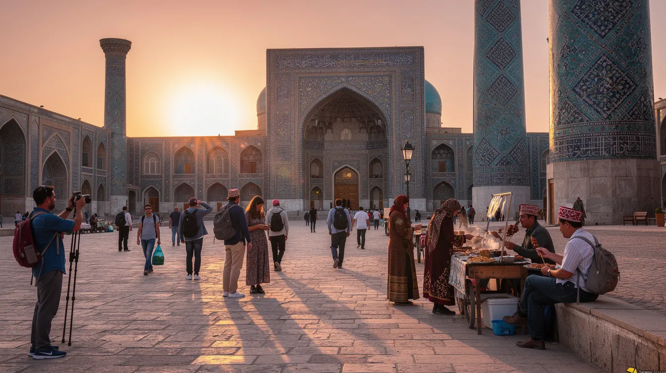
Registan Square is the soul of Samarkand and a masterclass in Timurid urban design. Three monumental madrasahs Ulugh Beg, Sher-Dor, and Tilla-Kari — compose a breathtaking ensemble. Arrive at first light for near-empty squares and soft shadows, or right before sunset when tiles glow. Interiors hide cool courtyards and former study cells where calligraphy and astronomy once threaded daily life. Use the map to locate nearby viewpoints offering oblique angles for photography without crowds.
North of Registan, the Shah-i-Zinda necropolis lines a narrow passage of mausoleums decked in masterful faience. The experience is kinetic: steps rise, blue arcs curve, and panels dazzled by restoration contrast with centuries of weathering. The samarkand map will guide you to the southern gate, mark restroom locations, and indicate which side lanes offer the best close-ups of tilework without bottlenecks. Early mornings are serene, while late afternoons find deeper color and an emotive procession of visitors.
Between them stands Bibi-Khanym Mosque, once among the largest in the Islamic world. Its reconstructed portal and domes make an arresting skyline, while fragments and museum panels tell a story of ambition, earthquake damage, and revival. Your route from Registan to Bibi-Khanym benefits from detours through side streets lined with bread ovens. The map flags these bakeries so you can sample fresh, sesame-dusted non while the crust still crackles.
Southwest lies the Gur-e-Amir Mausoleum, where Timur rests beneath a single soaring dome. The interior’s gold-toned muqarnas canopy feels intimate despite its grandeur. Outside, quiet gardens invite a reflective break. Plotting this stop after Registan produces a calm rhythm before you swing back through pedestrian lanes toward evening light shows on the square.
To the east, the Ulugh Beg Observatory once anchored a campus of science. Today you can view the remains of a monumental sextant and a small museum that frames Samarkand not only as a trading power but also as a center of knowledge. En route, consider the Afrasiyab Museum to the north, where murals and exhibits unlock the city’s pre-Timurid story. The samarkand map draws an intuitive arc from the modern city into archaeology, with transit and walking options labeled for both.
Don’t skip the Hazrat Khizr Mosque, poised over the river valley with a fine terrace overview. Its vantage point helps you visualize how the historic core, bazaar, and older settlement mounds relate. If you love satellite views, toggle the elevation layer to appreciate the subtle ridge that carries you from Bibi-Khanym up to Shah-i-Zinda.
Cultural Experiences
Just beyond Bibi-Khanym’s shadow, Siab Bazaar buzzes with fruit pyramids, spice mounds, and bread baskets scored in decorative patterns. Use the map to trace an arc through produce halls to sweets counters, then out to tea vendors. Mark a bakery or two for an early-morning return when loaves are pulled fresh from tandoors. If you’re curious about craft traditions, check the map’s artisan layer for ceramicists, embroiderers, and miniature painters who open their studios to visitors.
South of the historic core, the Konigil Paper Mill revives ancient mulberry-bark papermaking beside a leafy stream. The route there threads semi-rural lanes that feel worlds away from Registan even though the distance is modest. Mark it as a late-morning excursion paired with a riverside lunch. Back in town, keep tabs on seasonal performances at cultural centers where maqom (traditional music) and dance animate courtyards in the evening. Your path through these experiences becomes a necklace of small discoveries tied together by a well-planned loop.
Food gilds your route decisions. Pin favorite plov canteens near your midday waypoint, note lagman noodle stops for cooler evenings, and add a chaihona where you can rest under carved ayvans (pillared verandas). The map helps balance your appetite with walking times so you don’t arrive ravenous after the kitchens close for a midday lull.
How to Use the Samarkand Map

The objective is simplicity: see what matters at a glance, then fine-tune your day with a few taps. The samarkand map opens to a clean view of the historic core with color-coded layers for Heritage, Food, Viewpoints, Transit, and Amenities. Toggle layers on and off to avoid information overload. When you zoom, the map reveals finer details like minor gates, shaded alleys, and small mosques that can turn a long avenue into a peaceful shortcut.
Wayfinding blends geolocation with context. The familiar blue dot helps you orient, while smart labels note alternate spellings in Uzbek, Russian, and English. Search “Shah-i-Zinda / Shohi Zinda / Шохи Зинда” and the result groups under one pin. Walking times adapt to your pace if you enable activity tracking. Photographers can switch to a sun-path overlay to visualize golden hour at Registan and shadow lines along the Shah-i-Zinda stairway.
When connectivity wavers, download an offline map tile set for the whole historic center and key outskirts such as Konigil and the Observatory. Layers sync to your device so filters continue to work. If you’re traveling with companions, enable shared pins so everyone sees the same plan. You’ll spend less time negotiating on street corners and more time savoring details like carved doors and painted ceilings.
- Choose your anchor: set Registan as “Home” on the map, then star 5–7 must-sees within a 1.5 km loop.
- Toggle layers: keep Heritage, Food, and Amenities on; switch Viewpoints on near sunrise or sunset.
- Download offline: cache the historic center and one suburban pocket you plan to visit that day.
- Plot breaks: add tea stops every 60–90 minutes to pace tile-gazing and keep energy steady.
- Save alternates: pin one rain plan (museum) and one “crowd-escape” park close to your route.
Transit tools prioritize clarity. Bus corridors appear in muted lines with labeled stops near landmarks, while taxi pick-up points mark legal drop-offs outside pedestrian zones. The samarkand map also highlights traffic-calmed streets where walking feels safer with kids, and it flags underpasses or crossings at wide avenues. If you prefer cycling, check which roads are gentle grades and where cobbles or construction might slow you down.
Modern Amenities
Great trips hinge on small comforts, so the Amenities layer puts practical needs front and center. ATMs and currency exchange desks appear with notes on card networks, while pharmacies and clinics cluster near major squares for easy access. Drinking-water refill points and clean restrooms are flagged in tourist-heavy areas as well as near parks where families rest in the afternoon. You’ll also find public Wi‑Fi zones, eSIM and SIM card shops, and marked taxi stands so your day never stalls for lack of basics.
Accessibility matters. Ramps, even paving, and step-free museum entries are noted wherever available. For families, the map marks playgrounds and shaded courtyards where kids can decompress between monuments. If you’re sensitive to heat, look for tree-lined lanes and arcades that connect Bibi-Khanym to the bazaar; in winter, bookmark cozy tea rooms near drafty sites so you can warm up quickly.
Travel Tips for Navigating Samarkand
Think in arcs rather than zigzags. A classic morning loop pairs Registan with Bibi-Khanym and Siab Bazaar, then climbs to Shah-i-Zinda while the sun turns tiles electric blue. After lunch, drift toward Gur-e-Amir for golden hour. If you’re short on time, take a taxi to the Observatory first, then walk downhill through neighborhoods toward the center, catching quiet corners you might miss if you move only along main roads.
Time of day transforms the experience. Mornings suit interior photography before tour groups arrive; midday light is strong, so schedule museums, tea, or a paper-mill visit; late afternoons make domes glow and shadows deepen carving details. Fridays can be busier around mosques, and some spaces may close during prayer. Carry a light scarf to show respect at religious sites, and dress with shoulders and knees covered for smoother entry.
Language and spelling vary across signs and maps. Uzbek often uses Latin script, while older signage and locals may use Russian names. If a search fails, try alternate forms: “Registan / Registon,” “Bibi-Khanym / Bibi Xonum,” “Ulugh Beg / Ulug‘bek.” The map’s multi-spelling search helps, but you can also ask a vendor to point to your pin to confirm you’re headed the right way.
Moving around is straightforward once you understand the options. City buses and minibuses run main corridors between the train station, modern avenues, and the old center, but their numbers can shift, so check on the spot with station staff or shopkeepers. Taxis are plentiful; agree on a fare before boarding or use a reputable app. Pedestrianized pockets cluster around Registan and Bibi-Khanym, and short alleys can outsmart traffic. Comfortable shoes matter more than you think, especially on cobbles and steps.
Money and connectivity shape logistics. The local currency is the Uzbek som, and card acceptance is broad in tourist areas but not universal in small shops or taxis. Withdraw cash in daylight at bank ATMs and keep small bills for markets. For navigation reliability, buy a local SIM or an eSIM and download offline data in your accommodation’s Wi‑Fi. Screenshots of tickets and opening hours are handy backups if mobile data dips.
Photography rewards patience and etiquette. People are friendly, but always ask before taking portraits, especially in markets and religious spaces. Tripods can be restricted; a compact setup and steady hand serve better in tight mausoleums. For skyline shots, Hazrat Khizr’s terrace and several small parks near Registan offer layered views at dusk. If you chase the “blue hour,” set your route so you’re already in position as the call to prayer rolls across the domes.
Food punctuates the day. Use the map to pin a morning non bakery and a lunchtime plov canteen near your midpoint. Vegetarians do well with salads, soups, and stuffed breads; check menus or ask for lagman without meat. In the bazaar, taste before you buy and carry wet wipes for sticky halva or dried fruit samples. Afternoons invite a tea break under carved woodwork where shade and tilework mingle.
Seasonal tweaks help. Summers are hot, so plan indoor or shaded stops in early afternoon and carry a refillable bottle. Winter light is crisp and crowds thin, but pack layers and warm breaks. Spring and autumn balance temperature and color, with fruit stalls bursting at the bazaar. In any season, a small daypack with sunscreen, scarf, and water will keep you moving without frequent detours.
Respectful behavior keeps doors open. Keep voices low in shrines, avoid blocking narrow passages at Shah-i-Zinda, and follow signage where restoration is ongoing. Vendors appreciate a smile and clear “no, thank you” if you’re not browsing. If you get lost, trust the samarkand map for bearings, then confirm with a local; their shortcut might reveal the day’s favorite memory.
Wrap your route with intention. Set one final look at Registan from a side street where the domes peek over rooftops, or climb toward Shah-i-Zinda as dusk turns tiles to cobalt. Plan your last tea stop before taxis surge, and star the places you missed for tomorrow. With a well-used samarkand map, the city’s legendary beauty aligns neatly with your own rhythm, leaving you full of images, flavors, and a sense that you walked the Silk Road on your own terms.